
Moon Phase Today Culiacán
On Sunday, October 4, 2026, the moon in Culiacan is a Waning Crescent with 34% illumination. Moon age: 23.7 days.
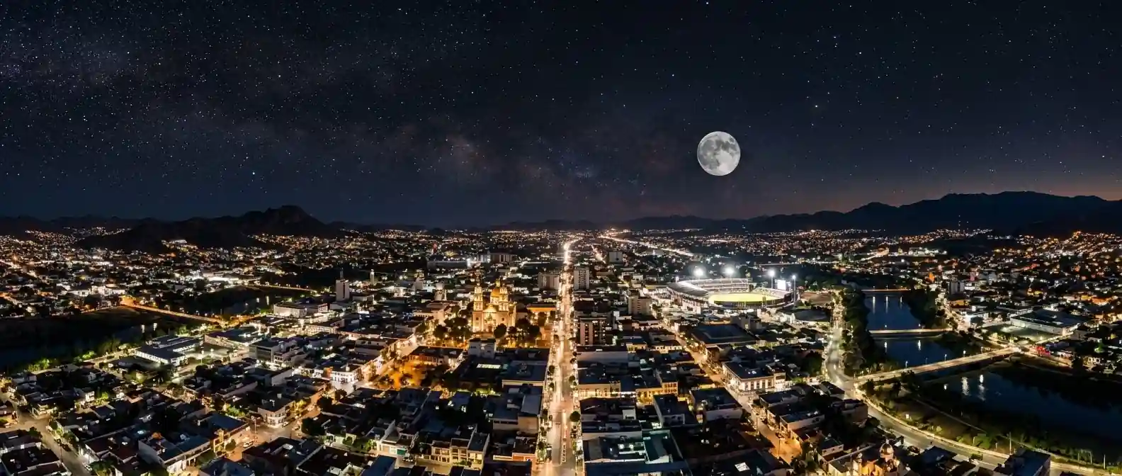
☽ Best Places to View the Moon in Culiacán, Mexico
Culiacán lies in central Sinaloa within a broad river valley and plain, with the Humaya and Tamazula rivers joining to form the Culiacán River. Mountainous terrain rises toward the Sierra Madre Occidental east of the city, giving you both low river corridors and higher viewpoints for Moon photography.
Parque Las Riberas – Three-River Corridor
Municipality describes it as extending about 12 km along the Humaya, Tamazula and Culiacán rivers, covering roughly 120 hectares, with walking trails, cycling infrastructure, picnic areas and open spaces. The Culiacán River is formed where the Humaya and Tamazula meet, at the Parque Acuático / Tres Ríos confluence area, which is one feature of the larger park. Current municipal tourism information lists Parque Las Riberas as Abierto todo el día; conditions and individual facilities can vary.
Isla de Orabá – Urban Island at Confluence
Urban island park where the rivers meet, linked to Parque Las Riberas. These are urban riverfront locations, so they are useful for Moon-over-city and Moon-over-water compositions rather than dark-sky observing. Open lawns and river channels provide broad sky views within city center.
La Lomita – Hilltop Church with Atrio-Mirador
Municipality describes La Lomita as a hilltop church with an atrio-mirador and panoramic views over Culiacán. Small hill with church and viewpoint. The elevated position can provide a different perspective over the city and surrounding landscape. Municipal tourism page specifically mentions photographers and views of the city at sunset or at night.
Parque Culiacán 87 – Large Urban Recreation Complex
Large urban recreation complex with gardens, sports facilities, a lake and open areas. Check current park and facility hours before planning a Moon session, as municipal sources list varying hours by area and facility, with individual facilities operating on their own schedules. The official Parque Culiacán site shows current 2026 activities.
Eastern Highlands – Mountainous Terrain
Mountainous terrain rises east of the city toward the Sierra Madre Occidental. Higher ground can provide broader sightlines, but atmospheric clarity and artificial lighting vary considerably by location. The municipality has extensive valley and plain areas with mountainous terrain to the east and northeast per INEGI municipal topographic mapping.
Tamazula & Humaya Riverbanks – Western Plain Corridor
The coastal plain lies to the west and is crossed by four regional rivers: Humaya, Tamazula, Culiacán and San Lorenzo. Riverbanks provide flatter open horizons toward the plain for low-angle Moon photography and broad sky views along walking and cycling paths.
◉ Best Times for Moon Photography in Culiacán
📷 Quick Tips for Culiacán
🕐 Timezone
Pacific Standard Time (PST) — UTC−7 year-round; no daylight-saving clock changes per CENAM Pacific zone listing for Sinaloa.
📍 Geography Note
Horizons: Culiacán lies in central Sinaloa within a broad river valley and plain, with Humaya and Tamazula rivers joining to form Culiacán River at Parque Acuático / Tres Ríos confluence area per municipal government. Parque Las Riberas extends approximately 12 km along Humaya, Tamazula and Culiacán rivers covering roughly 120 hectares with walking trails, cycling infrastructure, picnic areas and open spaces. Coastal plain to west crossed by four regional rivers Humaya, Tamazula, Culiacán and San Lorenzo.
Elevation: Municipality area approximately 4,758 km² per Culiacán municipal government, about 8.16% of Sinaloa. City elevation about 64 m above sea level per municipal government. Broad valley and plain with mountainous terrain rising east toward Sierra Madre Occidental, INEGI municipal topographic mapping covers entire municipality.
Access: Parque Las Riberas current municipal tourism information lists as Abierto todo el día open all day; conditions and individual facilities can vary. Parque Culiacán 87 large urban recreation complex with gardens, sports facilities, lake and open areas, check current park and facility hours. La Lomita hilltop church with atrio-mirador and panoramic views over Culiacán per city tourism, noted for photographers and views at sunset or night.
The moon phase today in Culiacán is shown above. For moon phase today anywhere else, visit the calculator on our home page.
◐ What It Feels Like
At Parque Las Riberas extending about 12 km along three rivers covering roughly 120 hectares, walking trails and cycling infrastructure follow the Humaya, Tamazula and Culiacán rivers where the Culiacán River is formed at the confluence.
At Isla de Orabá, urban island lawns linked to the river parks hold open sky and city lights, useful for Moon-over-city and Moon-over-water compositions rather than dark-sky observing.
Above the valley on La Lomita, a hilltop church with atrio-mirador offers panoramic views over Culiacán, noted for photographers at sunset and night, while mountainous terrain rises east toward the Sierra Madre Occidental.
"Three rivers joining in the city, island lawns within the river parks, and a hilltop atrio-mirador above the valley."
✓ Checklist for Lunar Observers
Before You Go
- Check moonrise / moonset azimuth — determines alignment along Humaya, Tamazula and Culiacán corridors
- Check SMN — haze and cloud can differ between valley floor at about 64 m and higher terrain east
- Confirm access — Parque Las Riberas Abierto todo el día per municipal tourism about 12 km 120 ha, Parque Culiacán 87 hours vary by area and facility, La Lomita hilltop church with panoramic views
What to Bring
- Telephoto and wide camera lenses for river and hilltop foregrounds
- Tripod for landscape and bracketing — useful for multi-exposure, close Moon can be handheld
- Lens cloth for dust, dew or condensation
- Water and an extra layer — temperatures can change noticeably with elevation and after sunset
On the Night
- Manual focus on lunar limb
- Bracket for disc vs. foreground — difficult to retain both in single exposure
- Stay on designated paths and observe posted access rules
- Higher ground can provide broader sightlines, but darkness still depends on nearby artificial light and current access
? Culiacán Moon Phase — Frequently Asked Questions
Q. What is the moon phase today in Culiacán?
The moon phase today in Culiacán is a Waning Crescent with 34% illumination. The next full moon is in 22 days, on Oct 25. Moonrise is at — and moonset at 2:09 PM.
Q. Where is the best place to view the moon in Culiacán?
Parque Las Riberas is the standout, a riverfront park extending about 12 km along the Humaya, Tamazula and Culiacán rivers and covering roughly 120 hectares, with walking trails and open spaces. Isla de Orabá, an urban island linked to the park at the river confluence, has open lawns and broad sky views. La Lomita, a hilltop church with an atrio-mirador, gives panoramic views over the city, and municipal tourism material specifically mentions views at sunset and at night. Parque Culiacán 87 and the mountainous terrain east of the city toward the Sierra Madre Occidental add a large recreation complex and higher sightlines, though all the urban sites are light-polluted.
Q. Where does the moon rise and set in Culiacán, and how high does it climb?
At about 25°N, Culiacán sees the moon rise and set within roughly 30° of due east and due west. A winter-solstice full moon can pass through or just north of the zenith, while a summer full moon culminates much lower, at roughly 40° in the south. The Sierra Madre Occidental rises to the east, so a rising moon can appear from behind the mountainous terrain later than the flat-horizon time, while the coastal plain to the west gives a lower, more open horizon for moonset. Exactly how the moon lines up with the rivers, the city or the hills depends on the date and your position.
Q. How do humidity, haze and light pollution affect moon viewing in Culiacán?
Culiacán sits in a broad river valley and plain, and humidity, haze and changing twilight levels can soften the moon and change the look of a scene, especially when it is low over the valley. Weather can also differ between the valley floor at about 64 m and higher ground to the east. City lighting rarely limits the lunar disc itself but washes out earthshine, and higher ground gives broader sightlines without guaranteeing darkness. Check the Servicio Meteorológico Nacional for haze, wind and cloud before heading out.
Q. What camera settings and phases work best for moon photography in Culiacán?
For a full moon, start with Looney 11 (f/11, ISO 100, 1/100 s) and refine using your histogram, particularly when the moon is low over the valley. The moon is much brighter than a dark foreground, so shoot RAW and bracket or blend exposures to keep both crater detail and the river, park and city lights. A waxing gibbous works well at blue hour at Parque Las Riberas, Isla de Orabá and La Lomita while the foreground is still lit, and a full moon rises around sunset. A 200–400 mm lens compresses the moon against Isla de Orabá's trees, the La Lomita church silhouette or river bridges, and manual focus on the moon with magnified live view keeps it sharp.
Q. Can I photograph the moon at Culiacán's riverfront parks and viewpoints after dark?
Access varies by site. Current municipal tourism information lists Parque Las Riberas as open all day, though conditions and individual facilities can vary. Parque Culiacán 87 has hours that differ by area and facility, so check current schedules before an evening session. La Lomita's atrio-mirador is highlighted by the municipality for views at sunset and at night, but it is worth confirming current access before you plan around it.
Q. Does this page work for cities besides Culiacán?
This page is set up specifically for Culiacán, Mexico. For the moon phase in any other city or location worldwide, use the Dynamic Moon Phase Calculator on the moonphase.today home page.
✦ Explore Further
Moon Phase Today: Chihuahua
Check tonight's moon phase in Chihuahua, northeast of Culiacán across the Sierra Madre.
🌵Moon Phase Today: Hermosillo
See the moon over Hermosillo, north of Culiacán along Mexico's Pacific-side desert corridor.
🇲🇽Moon Phase in Mexico
Browse moon phase pages for cities across Mexico, from Tijuana to Cancun.
🌍World Moon Phase Directory
Find the moon phase, rise and set times for cities in every region of the world.
NASA Moon Phase & Libration Gallery
NASA's Scientific Visualization Studio's daily renders of the moon's exact phase, libration, and orientation, straight from official mission data.