
L96 Leibnitz Mountains
One of the Lunar 100’s most disputed identifications — a jumble of high terrain along the South Pole–Aitken basin’s rim that even 18th-century cartographers couldn’t agree on. Only favorable southern libration brings it into view at all.
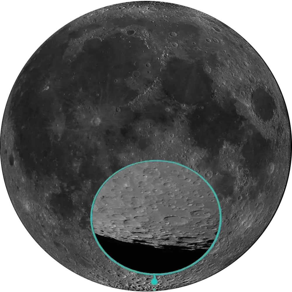
L96 Leibnitz Mountains
South Polar Limb · SPA Basin Rim📉 Vital Statistics
🔭 Field Notes
This is a target defined more by history than by a clean boundary. What you’re actually looking for is a jumble of peaks poking above the horizon along the Moon’s south polar limb — seen edge-on, foreshortened, and shifting with each month’s libration. Later selenographers disagreed over which peaks Schröter had meant, and that confusion was never fully resolved. Favorable southern libration is highly desirable; without it, the peaks are much harder to distinguish from the surrounding jagged limb.
- ▶ A Name Cancelled by the Catalog: “Leibnitz Mountains” was part of the original 1935 IAU nomenclature, but by 1971 the designation was dropped from Menzel’s revised lunar catalog, alongside several other proposed ranges, for not corresponding to any single, coherent mountain chain. It still appears informally on some modern maps, but it was never a well-defined feature to begin with.
- ▶ Extreme Terrain Along a Hidden Edge: The SPA region contains some of the Moon’s most extreme topographic relief, with exceptionally high terrain along parts of the basin’s mountainous margins. Much of this rim sits on the far side, and combined with the historical confusion over Schröter’s original designation, these peaks remain far less cataloged than better-known near-side ranges like the Apennines.
- ▶ One Peak Finally Got a Name: A flat-topped mountain in the same broader south-polar region, informally called “Leibnitz Beta” for decades, was officially named Mons Mouton in 2022 (approved by the IAU in early 2023), honoring NASA mathematician Melba Roy Mouton — though whether it corresponds to Schröter’s original Leibnitz designation remains part of the broader identification dispute. At roughly 6 km base-to-peak, it’s the Moon’s tallest officially named mountain, and its extended periods of sunlight have made it a candidate area of interest for future south-pole exploration.
📍 Nearby L100 Targets
- L45 Maurolycus: A large, prominent walled plain roughly 1,310 km away in the southern highlands — a much easier, well-defined target by comparison, sitting far enough from the pole to avoid the identification problems that plague this one.
- L55 Baco: A worn, eroded crater with a low central peak roughly 1,035 km away, offering a clean contrast to the ambiguous, disputed terrain of the “Leibnitz Mountains.”
- L94 Drygalski: A large limb crater roughly 405 km away, viewable from Earth only in profile under favorable libration — its central peak has yielded a detection of pure crystalline plagioclase in infrared spectral data.
🚀 Mission Log
Target Acquisition
Head for the south polar limb — and drop your expectations of a clean target
Point toward 85.0°S, 30.0°E, right at the Moon’s south polar limb. There’s no single defined peak or chain to lock onto here — you’re looking for a jumble of high terrain poking above the horizon, associated with the topographically high rim of the South Pole–Aitken basin. Go in expecting an identification challenge, not a landmark.
Favorable southern libration isn’t optional here
Seen from Earth, this terrain sits edge-on and badly foreshortened, shifting with each month’s libration cycle. Without favorable southern libration, the peaks are extremely difficult to pick out from the rest of the jagged limb. Check a libration calendar and wait for a night when the south pole is tipped toward you before you even attempt this one.
Know that you’re chasing an obsolete range name, not a formal landmark
“Leibnitz Mountains” is an informal historical designation rather than a current IAU feature name — it was dropped from official lunar nomenclature in the early 1970s as representing no single, coherent mountain chain. The old designation doesn’t map cleanly onto one modern named feature or a precisely bounded range. Treat this as an identification challenge: you’re looking for the general stretch of rugged, elevated terrain along the limb historically associated with the name, not a feature with a clearly marked edge.
From the Leibnitz region to Maurolycus, Baco, and Drygalski
Roughly 1,310 km away, Maurolycus (L45) is a large, prominent walled plain in the southern highlands — an easier, well-defined target by comparison, sitting far enough from the pole to avoid the identification problems here. About 1,035 km away, Baco (L55) is a worn, eroded crater with an unusually smooth floor, offering a clean contrast to this ambiguous terrain. And roughly 405 km away, Drygalski (L94) is a large, heavily foreshortened limb crater that’s especially difficult to resolve from Earth, whose central peak has yielded a detection of pure crystalline plagioclase in infrared spectral data.
📝 Observation Log — L96 Leibnitz Mountains
0/4 CompleteIs the Leibnitz region visible tonight?
This stretch of high terrain sits right at the south polar limb near 85.0°S, 30.0°E, along the mountainous rim of the South Pole–Aitken basin. Seen edge-on and badly foreshortened from Earth, it’s practically invisible without a favorable southern libration tipping the pole toward you — check a libration calendar before you plan a session here.
Check Moon Phase TodayReturn to the List
Ready to find the next target? Go back to the full map to see what else is visible tonight.
← Back to Lunar 100 Map
When to Observe the Leibnitz Mountains
Go in expecting an identification challenge, not a landmark. This is one of the most disputed identifications in the entire Lunar 100 — even the exact peaks corresponding to the original 18th-century designation remain debated among lunar cartographers.
- Head for the South Polar Limb, Drop Your Expectations of a Clean Target: Point toward 85.0°S, 30.0°E, right at the Moon’s south polar limb. There’s no single defined peak or chain to lock onto — you’re looking for a jumble of high terrain poking above the horizon, associated with the topographically high rim of the South Pole–Aitken basin.
- Favorable Southern Libration Isn’t Optional: Seen from Earth, this terrain sits edge-on and badly foreshortened, shifting with each month’s libration cycle. Without favorable southern libration, the peaks are extremely difficult to pick out from the rest of the jagged limb. Check a libration calendar and wait for a night when the south pole is tipped toward you before you even attempt this one.
- Know You’re Chasing a Historical Range Name, Not a Current IAU Feature: “Leibnitz Mountains” is a historical designation rather than a current IAU feature name. Treat this as an identification challenge: you’re looking for the general stretch of rugged, elevated terrain along the limb historically associated with the name, not a feature with a clearly marked edge.
What to Look For
What you’re actually looking for is a jumble of peaks poking above the horizon along the Moon’s south polar limb, seen edge-on, foreshortened, and shifting with each month’s libration. Later selenographers disagreed over which peaks Schröter had meant, and that confusion was never fully resolved.
“Leibnitz Mountains” was part of the original 1935 IAU nomenclature, but by 1971 the designation was dropped from Menzel’s revised lunar catalog, alongside several other proposed ranges, for not corresponding to any single, coherent mountain chain. The name still appears in historical and informal lunar observing material, but the exact peaks corresponding to Schröter’s original designation remain disputed.
The SPA region contains some of the Moon’s most extreme topographic relief, with exceptionally high terrain along parts of the basin’s mountainous margins. Much of this rim sits on the far side, and combined with the historical confusion over Schröter’s original designation, these peaks remain far less cataloged than better-known near-side ranges like the Apennines.
The flat-topped mountain long informally called “Leibnitz Beta” was officially named Mons Mouton by the IAU in early 2023, honoring NASA mathematician Melba Roy Mouton — though whether it corresponds to Schröter’s original Leibnitz designation remains part of the broader identification dispute. At roughly 6 km base-to-peak, it’s the Moon’s tallest officially named mountain, and its extended periods of sunlight have made it a candidate area of interest for future south-pole exploration.
The Science: A Name in Search of a Feature
Most Lunar 100 targets are defined by their geology. This one is defined as much by two centuries of cartographic disagreement — and by its accidental connection to the Moon’s oldest widely recognized major impact basin.
Vital Statistics
Located at 85.0°S, 30.0°E, on Rükl chart 73, V, the Leibnitz Mountains have no defined diameter — this is an informally bounded stretch of peaks, not a single defined feature. It’s a stretch of high, rugged peaks along the south polar limb, associated with the mountainous topographic expression of the South Pole–Aitken (SPA) basin margin. It was named by Johann Schröter in the 18th century for Gottfried Wilhelm Leibniz; the designation was cancelled from formal lunar nomenclature in Menzel’s 1971 catalog revision as representing no single, coherent mountain chain. It’s tied to the South Pole–Aitken basin, the Moon’s oldest widely recognized major impact basin, generally placed in the Pre-Nectarian and probably more than 4.3 billion years old. Its L100 distinction: one of the most disputed identifications in the entire Lunar 100.
A Rim Older Than Its Own Name
The terrain this target points to is real and extraordinary even if the name attached to it never quite was: the SPA basin’s mountainous margin holds some of the most extreme topographic relief on the Moon, tied to an impact basin older than almost any other feature in the Lunar 100. What’s uncertain isn’t the geology but the label — which peaks, precisely, Schröter meant when he named them, and whether any single chain ever matched his description.
Mission Record
Lunar Orbiter IV’s systematic photographic coverage in 1967 greatly improved views of the lunar limb and polar regions, although the identity and extent of the historically named peaks remained unresolved. Clementine’s 1994 laser altimetry provided the first near-global topographic map of the Moon and revealed the extraordinary scale and depth of the South Pole–Aitken basin, establishing it as the Moon’s largest and deepest recognized impact basin. Lunar Reconnaissance Orbiter, in orbit since 2009, has used LOLA altimetry to provide detailed topographic mapping of the south-polar terrain and measured Mons Mouton’s exceptional relief; the mountain’s official name was later proposed by the VIPER mission team and approved by the IAU.
Most Lunar 100 targets are chosen for a feature you can pin down. The Leibnitz Mountains were chosen for a name that never quite resolved into one — and more than two centuries after Schröter first used it, the closest thing to a resolution is a single, precisely measured summit called Mons Mouton.