
Moon Phase Today Aguascalientes
On Sunday, October 4, 2026, the moon in Aguascalientes is a Waning Crescent with 34% illumination. Moon age: 23.7 days.
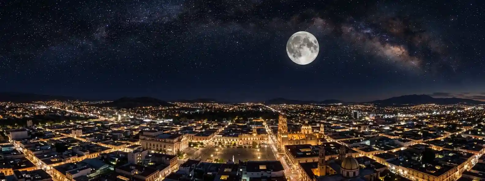
☽ Best Places to View the Moon in Aguascalientes, Mexico
Aguascalientes is an inland city on Mexico's central plateau within the Aguascalientes River basin and valley, at approximately 1,878 m above sea level. The city has a broad urban landscape with higher terrain to the west and southwest, including Cerro del Muerto, and surrounding regional terrain such as the Sierra Fría.
Cerro del Muerto – Monumento Natural
Mountain formation that resembles a lying man and a popular place for hiking with panoramic views of the city. Designated in 2008 as a state Monumento Natural under the Ley de Protección Ambiental para el Estado de Aguascalientes. Official decree locates it in both municipalities of Aguascalientes and Jesús María. The protected area is 5,862.034 hectares according to the state's management program, so it is not wholly inside Aguascalientes municipality. Conservation and recreational/ecotourism use is recognized, but that does not establish unrestricted nighttime access. Check current protected-area rules.
Parque Tres Centurias – Railway Heritage Park
Green space in the heart of the city combining historical elements including old train stations and locomotives, offering a special environment for relaxation and exploration. Features the Old Railway Station and open areas suitable for Moon-over-city compositions in an urban, light-polluted setting. It is an urban heritage and recreation site, not a designated night-sky location. Check current opening hours; do not assume nighttime access.
Parque Rodolfo Landeros Gallegos – Large Urban Park
Large recreational and educational complex with lake, gardens and open fields on the southern side of the city, offering paved walkways for casual strolls. Provides broad sky views while remaining within an urban area where artificial lighting is significant. Government material documents daytime operating periods including a 2024 event running 09:00–17:00, and a published fee schedule includes a special early-morning runner entry from 06:00–09:00. Check current opening hours; don't assume nighttime access.
Isla San Marcos & Mega Velaria – Fairgrounds Open Areas
Isla San Marcos complex with open plazas, lake and exhibition areas associated with the San Marcos Fair. Extensive open areas can provide wide horizons for Moon photography, but its facilities and event areas have varying access. Check current access before planning a Moon session, rather than treating the entire complex as always open.
Línea Verde – Linear Urban Recreation Corridor
Long linear urban recreation corridor crossing eastern Aguascalientes with walking and cycling paths, sports areas and open spaces. Provides an elongated corridor with open sky along its route. It is an urban corridor, so it should not be characterized as particularly dark, but useful for urban park Moon compositions.
Centro Histórico – Plazas and Elevated Urban Viewpoints
Historic-center plazas and nearby elevated urban viewpoints around Plaza de la Patria and the cathedral area. Open plaza foregrounds provide cityscape Moon compositions within a broad urban landscape on the central plateau, with higher terrain to the west and southwest providing additional perspective where public access allows.
◉ Best Times for Moon Photography in Aguascalientes
📷 Quick Tips for Aguascalientes
🕐 Timezone
Central Standard Time (CST) — UTC−6 year-round; no daylight-saving clock changes. Aguascalientes is in Mexico's Zona Centro per CENAM; seasonal clock changes were eliminated for the rest of Mexico outside the designated northern-border zone.
📍 Geography Note
Horizons: Aguascalientes is an inland city on Mexico's central plateau with a broad urban landscape and higher terrain to the west and southwest, including Cerro del Muerto. City lies within Aguascalientes River basin and valley. Surrounding regional terrain includes Sierra Fría as regional highland system, not directly surrounding the city core.
Elevation: Aguascalientes city is approximately 1,878 m above sea level per INEGI locality dataset. High-elevation inland city, not automatically clearer skies; haze, dust and light pollution remain important.
Access: Urban parks such as Tres Centurias and Rodolfo Landeros provide cityscape foregrounds, while Cerro del Muerto provides elevated natural scenery within a 5,862.034-hectare protected area spanning Aguascalientes and Jesús María municipalities, designated Monumento Natural on 26 May 2008. Check current opening hours and protected-area rules before planning an evening or nighttime session. Rodolfo Landeros has documented daytime periods 09:00–17:00 and early runner entry 06:00–09:00. Tres Centurias and Isla San Marcos also have varying facility access.
The moon phase today in Aguascalientes is shown above. For moon phase today anywhere else, visit the calculator on our home page.
◐ What It Feels Like
At Cerro del Muerto, a mountain formation resembling a lying man provides hiking routes and panoramic views, within a state protected area of 5,862.034 hectares across two municipalities designated as Monumento Natural in 2008.
At Parque Tres Centurias in the heart of the city, green spaces combined with old train stations and locomotives offer a special environment for relaxation with open areas suitable for photography where permitted.
In Parque Rodolfo Landeros Gallegos and Isla San Marcos, large parks with lakes and open fields provide broad horizons within the urban basin at approximately 1,878 m on the central plateau.
"Central plateau city in a river basin, railway heritage park in the heart, and a lying-man mountain shared with the neighboring municipality."
✓ Checklist for Lunar Observers
Before You Go
- Check moonrise/moonset azimuth — use exact observing location to determine whether Moon will align with city, hills or other foregrounds, as azimuth and declination vary by date
- Check SMN — haze, dust, cloud and wind can vary between urban basin and higher terrain to west and southwest
- Confirm access — Cerro del Muerto Monumento Natural 5,862.034 ha across Aguascalientes and Jesús María designated 26 May 2008, Tres Centurias heritage site, Rodolfo Landeros daytime periods 09:00–17:00 early runner 06:00–09:00, Isla San Marcos varying access
What to Bring
- Telephoto and wide for hill and park foregrounds
- Tripod for landscape and bracketing — useful for multi-exposure, close Moon can be handheld
- Lens cloth for dust, dew or condensation
- Water and extra layer — temperatures can change noticeably with elevation and after sunset at approximately 1,878 m
On the Night
- Manual focus on lunar limb — focus on Moon itself preferable when possible
- Bracket for disc vs. foreground — difficult to retain both in single exposure
- Stay on designated paths and observe posted access rules
- Urban parks provide open sightlines as light-polluted locations, useful for Moon-over-city photography rather than dark-sky observing, while higher terrain provides natural scenery where access permits
? Aguascalientes Moon Phase — Frequently Asked Questions
Q. What is the moon phase today in Aguascalientes?
The moon phase today in Aguascalientes is a Waning Crescent with 34% illumination. The next full moon is in 22 days, on Oct 25. Moonrise is at 12:44 AM and moonset at 2:42 PM.
Q. Where is the best place to view the moon in Aguascalientes?
Cerro del Muerto, a state Monumento Natural whose mountain profile resembles a lying man, offers hiking routes and panoramic views over the city, though conservation and recreational use does not mean unrestricted nighttime access, so check current protected-area rules. In town, Parque Tres Centurias combines green space with the Old Railway Station and old locomotives, and Parque Rodolfo Landeros Gallegos has a lake, gardens and open fields on the southern side. Isla San Marcos and the Línea Verde corridor offer wide open areas, and the plazas of the Centro Histórico around Plaza de la Patria and the cathedral give cityscape foregrounds. All the urban sites are light-polluted.
Q. Where does the moon rise and set in Aguascalientes, and does the terrain matter?
At about 22°N, Aguascalientes sees the moon rise and set within roughly 30° of due east and due west. When the moon's declination is north of the city's latitude, as it can be around a winter-solstice full moon, it passes almost overhead or slightly north of the zenith, while a summer full moon culminates much lower, roughly 40–45° up in the south. Higher terrain lies to the west and southwest, including Cerro del Muerto, so a setting moon can drop behind the hills earlier than the flat-horizon time, and whether the moon lines up with the hills, the city or open plain depends on the date and your exact position.
Q. Does Aguascalientes's altitude make for better moon viewing?
The city sits at about 1,878 m above sea level on the central plateau, so there is less atmosphere overhead than at the coast, but high elevation does not automatically mean clearer skies. Haze, dust and cloud remain important in the semi-arid climate, and weather and visibility can vary between the urban basin and the higher terrain. Urban light pollution also remains, which rarely limits the lunar disc itself but washes out earthshine, and the surrounding countryside is not automatically dark on a new moon. Check the Servicio Meteorológico Nacional for haze, wind and cloud before heading out.
Q. What camera settings and phases work best for moon photography in Aguascalientes?
For a full moon, start with Looney 11 (f/11, ISO 100, 1/100 s) and refine using your histogram, since haze, dust, cloud and changing twilight levels affect the scene. The moon is much brighter than a dark foreground, so shoot RAW and bracket or blend exposures to keep both crater detail and the park, city lights and hill silhouettes. A waxing gibbous is useful at blue hour at Parque Tres Centurias and Parque Rodolfo Landeros while the foreground is still lit, and a full moon rises around sunset. A 200–400 mm lens helps isolate the moon against Cerro del Muerto or the railway heritage buildings, and a light layer is worth carrying because temperatures can drop noticeably after sunset at this elevation.
Q. Can I photograph the moon in Aguascalientes's parks and on Cerro del Muerto after dark?
Access varies by site and should not be assumed. Government material documents daytime operating periods at Parque Rodolfo Landeros Gallegos, including a 2024 event running 09:00–17:00, and a published fee schedule lists an early-morning runner entry from 06:00 to 09:00. Parque Tres Centurias and Isla San Marcos have varying facility and event access, so check current hours before planning a session. Cerro del Muerto is a protected area spanning Aguascalientes and Jesús María, and its recognition for conservation and ecotourism use does not establish unrestricted night access.
Q. Does this page work for cities besides Aguascalientes?
This page is set up specifically for Aguascalientes, Mexico. For the moon phase in any other city or location worldwide, use the Dynamic Moon Phase Calculator on the moonphase.today home page.
✦ Explore Further
Moon Phase Today: León
Check tonight's moon phase in León, southeast of Aguascalientes on the central plateau.
📍Moon Phase Today: San Luis Potosí
See the moon over San Luis Potosí, another central-Mexico highland city to the east.
🇲🇽Moon Phase in Mexico
Browse moon phase pages for cities across Mexico, from Tijuana to Cancun.
🌍World Moon Phase Directory
Find the moon phase, rise and set times for cities in every region of the world.
NASA Moon Phase & Libration Gallery
NASA's Scientific Visualization Studio's daily renders of the moon's exact phase, libration, and orientation, straight from official mission data.