
Moon Phase Today Kitchener
On Friday, October 9, 2026, the moon in Kitchener is a New Moon with 0% illumination. Moon age: 28.9 days.
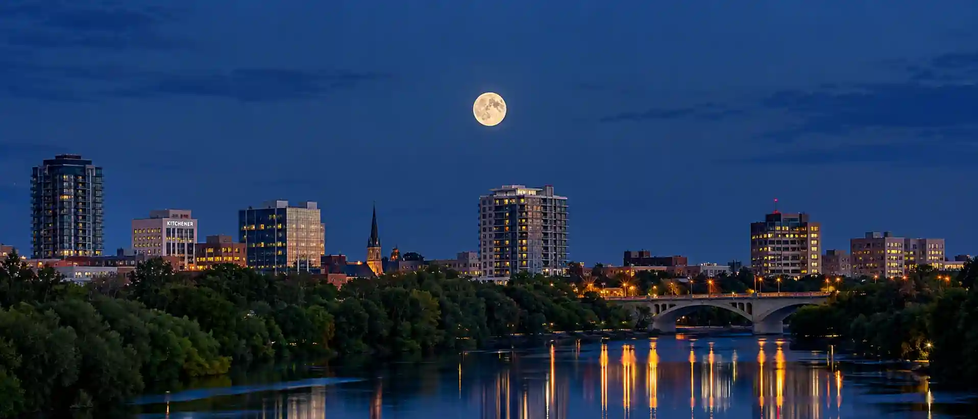
☽ Best Places to View the Moon in Kitchener, Ontario, Canada
Kitchener sits in Southwestern Ontario's lowland landscape within the Grand River watershed. The area offers gentle terrain, river corridors and large urban parks with open lawns and natural areas that provide broad sky views close to downtown.
Huron Natural Area – More Than 250 Acres
City's biggest natural space with more than 250 acres of protected forest and wetland and more than 7 km of trails. Located at 801 Trillium Drive in south end of Kitchener along Strasburg Creek, with trails, wetlands and lookout areas, streams, meadows, forests and wetlands.
Victoria Park – Oldest Park, Opened 1896
Victoria Park is Kitchener's oldest park and officially opened in 1896, opened to public August 27, 1896. The historic park surrounds a lake and features lawns, mature trees, bridges, the pavilion and the monument. Original site was a natural elongated pond centred on Schneider Creek with park landscape subsequently created and modified in 1895-96.
Walter Bean Grand River Trail – River Corridor
The Grand River forms a major natural corridor along Kitchener's eastern and southeastern side. The Walter Bean Grand River Trail runs more than 25 km through Kitchener from Kiwanis Park in the north to Doon Valley Golf Course in the south, with multiple access points and canoe launches.
McLennan Park – Elevated Former Landfill Site
Built on the site of a former landfill per City of Kitchener, McLennan Park has trails crossing an elevated landscape along with a skatepark, playground and other recreation facilities. The higher terrain can provide open sightlines over surrounding neighbourhoods.
Iron Horse Trail – Urban Linear Trail
Former railway corridor forms a multi-use trail between Kitchener and Waterloo, approximately 5 km per current City listing, dawn to dusk hours. Its relatively straight alignment can be useful for planning Moon positions along the trail.
Laurel Creek & Columbia Lake – Waterloo
Nearby Waterloo locations: Laurel Trail runs along Laurel Creek and connects toward Columbia Lake, with trail network linking Waterloo with Kitchener. Laurel Creek Conservation Area is a separate GRCA property with recreation facilities.
◉ Best Times for Moon Photography in Kitchener
📷 Quick Tips for Kitchener
🕐 Timezone
Eastern Time – EST UTC-5 / EDT UTC-4 in summer.
📍 Geography Note
Horizons: Kitchener sits inside the Grand River watershed on Southwestern Ontario's lowland plain. The Grand River itself runs along the city's eastern and southeastern edge, not through downtown, which is why the Walter Bean Trail gives you the longest open sky — more than 25 km from Kiwanis Park in the north to Doon Valley Golf Course in the south, with meadow breaks, canoe launches and valley views.
Elevation: No mountains, just gentle moraine and floodplain. The city covers 136.81 km² and sits around 300-360 m. Victoria Park downtown is low, built in 1895-96 around a natural elongated pond on Schneider Creek and opened August 27, 1896. The high points are human-made: McLennan Park is a former landfill turned hill with trails that look over the surrounding neighbourhoods. For real nature, Huron Natural Area on the south end is more than 250 acres of forest and wetland with over 7 km of trails.
Access: Victoria Park is central with parking around Jubilee Drive, David Street and Schneider Avenue. Huron Natural Area's main entrance is at 801 Trillium Drive — Strasburg Road access is closed for construction right now, use Trillium. Iron Horse Trail is about 5 km between Kitchener and Waterloo and is dawn to dusk. Just north of the city line, Laurel Trail follows Laurel Creek toward Columbia Lake and connects into the Kitchener trail network; Laurel Creek Conservation Area itself is a separate GRCA property.
The moon phase today in Kitchener is shown above. For moon phase today anywhere else, visit the calculator.
◐ What It Feels Like
At Huron Natural Area on Trillium Drive, more than 250 acres of protected forest and wetland hold trails and lookout areas with streams and ponds reflecting twilight.
At Victoria Park downtown, a historic lake and landscaped park provide an urban foreground of water, lawns, mature trees and heritage features with pavilion and monument.
Along the Grand River, the Walter Bean Trail follows the river corridor through Kitchener, providing long views across sections of the valley and surrounding natural areas.
"River corridor and rail trail under open sky, historic park lake downtown, and quiet meadows and forest at the city's edge."
✓ Checklist for Lunar Observers
Before You Go
- Check moonrise / moonset azimuth — determines alignment along river and trails
- Check Environment Canada — weather and cloud can differ between valley and higher ground
- Confirm access — Victoria Park parking around Jubilee Drive, Huron Natural Area main entrance 801 Trillium Drive with Strasburg Road access closed, Iron Horse Trail dawn to dusk
What to Bring
- Telephoto and wide for park and river foregrounds
- Tripod for landscape and bracketing — useful for multi-exposure, close Moon can be handheld
- Lens cloth for humidity
- Warm layers — check current park hours and access rules before nighttime session
On the Night
- Manual focus on lunar limb
- Bracket for disc vs. foreground — difficult to retain both in single exposure
- Stay on paths — natural areas with streams, meadows, forests and wetlands
- Higher ground can provide open sightlines, but darkness still depends on nearby artificial light
? Kitchener Moon Phase — Frequently Asked Questions
Q. What is the moon phase today in Kitchener?
The moon phase today in Kitchener is a New Moon with 0% illumination. The next full moon is in 17 days, on Oct 26. Moonrise is at 6:28 AM and moonset at 6:15 PM.
Q. Where is the best place to view the moon in Kitchener?
Victoria Park, Kitchener's oldest park, opened in 1896, surrounds a lake with lawns, mature trees, bridges and a pavilion and is central and low. The Walter Bean Grand River Trail runs more than 25 km through Kitchener from Kiwanis Park in the north to Doon Valley Golf Course in the south and gives the longest open sky along the Grand River corridor. For elevation, McLennan Park, built on a former landfill, has trails across a raised landscape with open sightlines over surrounding neighbourhoods, and Huron Natural Area in the south end offers more than 250 acres of forest and wetland with over 7 km of trails and lookout areas. The Iron Horse Trail between Kitchener and Waterloo is a straight urban linear option.
Q. Where does the moon rise and set in Kitchener, and how high does it climb?
At about 43°N, Kitchener's moon rises and sets roughly 35–40° either side of due east and west over each month, depending on its declination. A winter full moon climbs high, to roughly 70–75° above the southern horizon, while a summer full moon stays low, peaking at about 20°. Kitchener sits on a lowland plain with gentle moraine and floodplain terrain and no mountains, so the high points are human-made, such as McLennan Park, and trees and buildings are the main horizon obstruction. Check the moon's rise azimuth for your date and viewpoint before planning a shot.
Q. Can I line the moon up along a straight trail in Kitchener?
The Iron Horse Trail, a former railway corridor of about 5 km between Kitchener and Waterloo, has a relatively straight alignment that can be useful for planning where the moon will appear along the trail. The moon lines up with a straight path only on dates when its rise or set azimuth matches the trail's bearing, so check the azimuth for your date with a planning app before you go. The City lists the trail as open dawn to dusk, so a moonrise or moonset session needs to fit within those hours.
Q. What camera settings work best for moon photography in Kitchener?
For a full moon, start with the Looney 11 rule (f/11, ISO 100, 1/100 s) and adjust from your histogram. The moon is much brighter than a dark foreground, so shoot RAW and bracket exposures to keep crater detail while keeping park meadows, forest and water visible. A telephoto of 200–400 mm can isolate the moon against Victoria Park's pavilion, Huron's forest edge or McLennan's elevated terrain. Autofocus can hunt over dark parks, so switch to manual focus on the edge of the moon, and use a tripod for bracketing and steady horizons during blue hour.
Q. How does haze and humidity affect moon viewing in Kitchener?
Haze over the Grand River, summer humidity and reflections from park lakes can change the scene and soften lunar contrast, particularly when the moon is low, so refine your exposure with your histogram. Weather can differ between the valley and higher ground, so check Environment Canada for haze, wind and cloud cover before heading out. Carry a lens cloth for humidity and warm layers for cooler evenings.
Q. Can I photograph the moon in Kitchener's parks and trails after dark?
Access varies by site, so check current park hours and access rules before planning a nighttime session. The Iron Horse Trail is listed as dawn to dusk. Huron Natural Area's main entrance is at 801 Trillium Drive, and its Strasburg Road access is closed for construction, so use Trillium. Victoria Park has parking around Jubilee Drive, David Street and Schneider Avenue. Just north of the city line, Laurel Trail follows Laurel Creek toward Columbia Lake, and Laurel Creek Conservation Area is a separate GRCA property. Stay on paths in natural areas with streams, meadows, forests and wetlands.
✦ Explore Further
Moon Phase Today: Hamilton
Check tonight's moon phase in Hamilton, southeast of Kitchener at the western end of Lake Ontario.
📍Moon Phase Today: Brampton
See the moon over Brampton, east of Kitchener in the Greater Toronto Area.
🇨🇦Moon Phase in Canada
Browse moon phase pages for cities across Canada, from St. John's to Vancouver.
🌍World Moon Phase Directory
Find the moon phase, rise and set times for cities in every region of the world.
NASA Moon Phase & Libration Gallery
NASA's Scientific Visualization Studio's daily renders of the moon's exact phase, libration, and orientation, straight from official mission data.