
L85 Langrenus Rays
A 132 km terraced crater on the eastern shore of Mare Fecunditatis, its ejecta rays faded by billions of years of weathering — a visible record of just how slowly a lunar ray system dies.
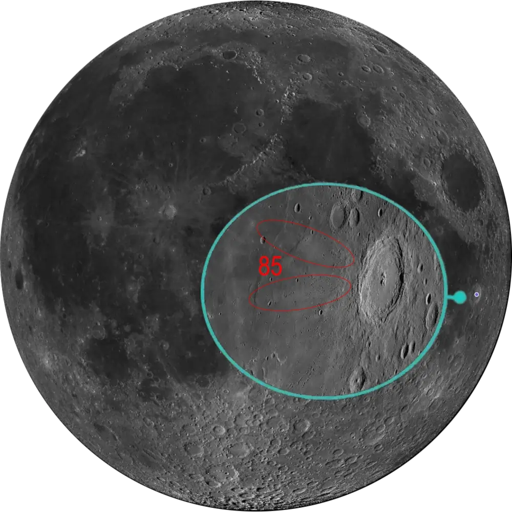
L85 Langrenus Rays
Eastern Limb · Mare Fecunditatis📉 Vital Statistics
🔭 Field Notes
Langrenus sits on the eastern shore of Mare Fecunditatis, its terraced walls and multi-peaked interior making it one of the most striking craters near the limb — T. W. Webb called it a superb object under oblique sunshine. It is also one of the very few craters still carrying the name its original mapmaker gave himself: Michael van Langren, who produced the first printed lunar map in 1645, named this formation after himself, and it has stuck ever since.
- ▶ A Ray System Past Its Prime: Langrenus is classed as Eratosthenian in age, meaning it postdates the Moon’s last major basin-forming impacts but predates the freshest Copernican craters like Tycho. Its ejecta rays are still traceable spreading west across the mare, but centuries to billions of years of space weathering have dimmed them well below the crisp, high-albedo streaks of a young ray crater — a visible record of just how slowly lunar rays fade rather than vanish outright.
- ▶ Ejecta as Far-Flung Sample Return: Researchers have estimated that roughly 10% of the soil the Soviet Luna 16 probe scooped up some 250–300 km to the northwest could be distal ejecta from Langrenus, a figure recent ejecta-thickness modeling has continued to support. In effect, one of the first robotic lunar sample-return missions may have unknowingly sampled this crater at long range — though the exact contribution remains a modeled estimate rather than a confirmed provenance.
- ▶ Terraces Wide Enough to Get Lost In: The inner wall of Langrenus is unusually broad and irregularly terraced, averaging some 20 km across, while a peak on the eastern rim climbs to about 3 km above the surrounding terrain outside the crater. The floor itself carries a mix of highland and mare-like spectral signatures, hinting at a history of impact melt and later infill.
📍 Nearby L100 Targets
- L16 Petavius: A floor-fractured crater roughly 500 km almost due south, famous for the broad graben-like rille running from its multi-peaked center to the southwest wall. It shares Langrenus’s Rükl neighborhood more than its geology — the two are closer in map position along the eastern limb than in any direct physical connection.
- L25 Messier & Messier A: A small, elongated crater pair roughly 450 km west-northwest, formed by a single grazing impact so shallow that part of the projectile ricocheted downrange to gouge a second crater and lay down parallel “comet tail” rays. Both this pair and Langrenus sit on Mare Fecunditatis and fall within the same stretch of lunar longitude, making them convenient targets under similar illumination even though they are geologically unrelated.
- L31 Taruntius: A young floor-fractured crater roughly 600 km to the northwest, on the opposite shore of Mare Fecunditatis, where uplifted magma pushed the entire floor upward and left it shallower than a fresh crater of its size should be. Like Messier, it lies close enough in longitude to Langrenus to catch morning or evening light around the same lunar day.
🚀 Mission Log
Target Acquisition
Find the eastern shore of Mare Fecunditatis
Locate Mare Fecunditatis and follow its shoreline east toward the limb. Langrenus sits right on that shore at 8.9°S, 60.9°E — a 132 km complex crater on Rükl chart 49. Unlike a deep-limb target, it doesn’t demand rare geometry to observe; its terraced walls and multi-peaked interior are visible in modest instruments any time it’s reasonably illuminated, which makes it a forgiving anchor point for a wider eastern-limb session.
Wait for oblique sunlight, not full illumination
Langrenus rewards a low sun angle far more than a fully lit disc — Victorian observer T. W. Webb called it a superb object precisely under oblique sunshine. Catch it near the terminator, either at local sunrise or sunset on the crater, so the terraced walls and central peaks throw long shadows and stand out in relief rather than washing out under high sun.
Work the terraces inward, then look for the rays
In a modest scope under good seeing, trace the unusually broad, irregularly terraced inner wall — it averages some 20 km across — down toward the multi-peaked floor, where the central peaks rise about 1 km above the floor. Look for a rim peak on the east side climbing roughly 3 km above the outside landscape. Then pan west across Mare Fecunditatis for the crater’s ejecta rays: still traceable, but visibly dimmed by their Eratosthenian age, a faded record of just how slowly lunar rays fade rather than vanish.
From Langrenus to Petavius, Messier, and Taruntius
South along the limb, roughly 500 km away, Petavius (L16) is a floor-fractured crater known for the broad graben-like rille running from its center to the southwest wall — a shared map neighborhood more than a shared geology. West-northwest, about 450 km off, the Messier & Messier A pair (L25) marks a single grazing impact whose ricocheting projectile gouged a second crater and laid down parallel “comet tail” rays — both share Mare Fecunditatis and similar illumination timing with Langrenus. Further northwest, some 600 km away on the opposite shore of the mare, Taruntius (L31) is a young floor-fractured crater whose uplifted magma pushed its floor shallower than a fresh crater of its size should be — another convenient catch under the same lunar-day lighting.
📝 Observation Log — L85 Langrenus Rays
0/4 CompleteIs Langrenus visible tonight?
Langrenus sits right on the eastern shore of Mare Fecunditatis near 8.9°S, 60.9°E, and is one of the more forgiving Lunar 100 targets to time — no rare geometry required. Even so, it’s best caught near local sunrise or sunset on the crater, when oblique sunlight throws its terraced walls and central peaks into relief rather than washing them out under a fully lit disc.
Check Moon Phase TodayReturn to the List
Ready to find the next target? Go back to the full map to see what else is visible tonight.
← Back to Lunar 100 Map
When to Observe Langrenus
Langrenus is one of the more forgiving Lunar 100 targets to schedule — it doesn’t demand rare geometry or exceptional seeing, just the right angle of sunlight to bring its terraces to life.
- Wait for Oblique Sunlight, Not Full Illumination: Langrenus rewards a low sun angle far more than a fully lit disc — Victorian observer T. W. Webb called it a superb object precisely under oblique sunshine. Catch it near the terminator, either at local sunrise or sunset on the crater, so the terraced walls and central peaks throw long shadows and stand out in relief.
- A Forgiving Anchor Point: Its terraced walls and multi-peaked interior are visible in modest instruments any time it’s reasonably illuminated, making it a good anchor for a wider eastern-limb session rather than a target that demands a single narrow window.
- For Orientation: Locate Mare Fecunditatis and follow its shoreline east toward the limb. Langrenus sits right on that shore at 8.9°S, 60.9°E.
What to Look For
Trace the unusually broad, irregularly terraced inner wall, reaching nearly 20 km across in places, down toward the multi-peaked floor. Look also for a peak on the eastern rim climbing to about 3 km above the surrounding terrain outside the crater.
Work inward from the terraces to the central peaks, which rise roughly 1 km above the crater floor — a cluster rather than a single summit, distinct from the simple central mountains seen in smaller craters.
Pan west across Mare Fecunditatis for Langrenus’s ejecta rays. They’re still traceable spreading across the mare, but millions to billions of years of space weathering have dimmed them well below the crisp, high-albedo streaks of a young ray crater.
Note that the floor itself carries a mix of highland material together with localized mare-like spectral characteristics, hinting at a history of impact melt and later infill rather than a single simple resurfacing event.
The Science: An Aged Ray System
Langrenus’s real interest for the Lunar 100 isn’t its size but its age bracket — old enough for its rays to visibly fade, yet young enough that they’re still there to see at all.
Vital Statistics
Located at 8.9°S, 60.9°E, on Rükl chart 49, Langrenus is a 132 km complex crater of Eratosthenian age, with central peaks rising roughly 1 km above its floor. Named for Michael van Langren (c. 1598–1675), its L100 distinction is its aged ray system — ejecta still traceable across Mare Fecunditatis, but visibly dimmed compared with a fresh ray crater.
A Ray System Past Its Prime
Langrenus is classed as Eratosthenian in age, meaning it postdates the Moon’s last major basin-forming impacts but predates the freshest Copernican craters like Tycho. Its ejecta rays are still traceable spreading west across the mare, but weathering over millions to billions of years has dimmed them well below the crisp, high-albedo streaks of a young ray crater — a visible record of just how slowly lunar rays fade rather than vanish outright.
Ejecta as Far-Flung Sample Return
Researchers have estimated that roughly 10% of the soil the Soviet Luna 16 probe scooped up some 250–300 km to the northwest could be distal ejecta from Langrenus, a figure recent ejecta-thickness modeling has continued to support. In effect, one of the first robotic lunar sample-return missions may have unknowingly sampled this crater at long range — though the exact contribution remains a modeled estimate rather than a confirmed provenance.
A Rare Case of Self-Naming
Langrenus is one of the very few craters still carrying the name its original mapmaker gave himself: Michael van Langren, who produced the first printed lunar map in 1645, named this formation after himself, and it has stuck ever since.
Mission Record
Lunar Orbiter Program imagery from 1966–67 provided the first detailed photographic coverage of Langrenus’s terraced walls and ray-covered surroundings, supporting later geologic mapping of the region. Luna 16 landed roughly 250–300 km northwest of Langrenus in Mare Fecunditatis in September 1970 and returned 101 grams of regolith, a sample later estimated to contain a meaningful fraction of distal Langrenus ejecta. Lunar Reconnaissance Orbiter’s LROC imagery has supported detailed geologic mapping of the crater’s terraces and floor units, while the Diviner Lunar Radiometer’s thermal infrared data have been used to study its nighttime thermal signature and estimate the bulk silicate composition of its central peak, complementing the crater-count and stratigraphic evidence behind its Eratosthenian age and helping track how far its rays have weathered.
Most Lunar 100 ray craters are chosen for how bright and fresh their rays look. Langrenus was chosen for the opposite reason — a record of just how long a ray system can persist after it stops looking young.