
L91 De Gasparis Rilles
A worn, lava-flooded crater turned into a railway switchyard of criss-crossing tectonic rilles, cutting directly across the crater itself in a textbook display of relative dating — visible only when low-angle sunlight throws shadow along each fault.
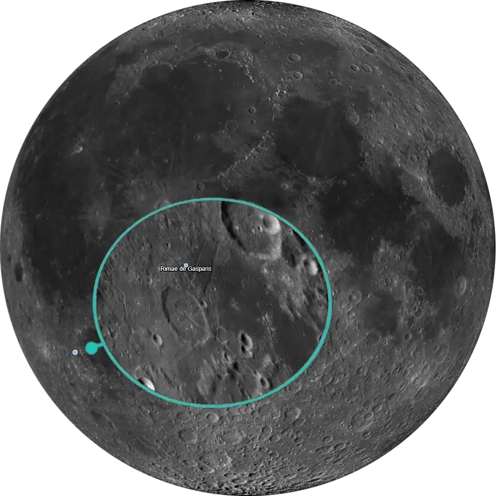
L91 De Gasparis Rilles
West Mare Humorum · Rille Convergence Hub📉 Vital Statistics
🔭 Field Notes
The small crater de Gasparis, just west of Mare Humorum, sits at the center of one of the Moon’s densest hubs of rille activity — with roughly nine rille branches converging on or near it, the area looks like a railway switchyard, much like the Triesnecker system on the other side of the disc. Unlike the sinuous, channel-like rilles carved by ancient lava flow, these are straight-to-gently-curved graben: fractures where a strip of crust has pulled apart and the block between the faults has dropped down. De Gasparis itself is a modest, worn crater with an eroded rim reaching about 0.8 km at its highest surviving point, its interior long since flooded by basaltic lava. The rilles cutting across it — designated Rimae de Gasparis — coincide with deep-seated faults, and ESA’s imaging of the site has linked the region’s stresses to a combination of factors including basin loading, crustal flexure, and the tail end of lava flooding across this part of the near side.
- ▶ The Switchyard: Roughly nine rille segments converge on or near the crater from several directions, intersecting across the surrounding terrain in a dense network rather than following any single simple path.
- ▶ A Lesson in Relative Dating: Because the rilles cut directly across de Gasparis crater itself, geologists can read a clear sequence straight from the landscape — the rilles must postdate the crater’s formation, a textbook example of using crosscutting relationships to establish lunar chronology.
- ▶ A Busy Neighborhood: The separate Rimae Mersenius system lies just to the northeast, close enough that the two rille fields are often described together as one of the most rille-dense stretches of the entire lunar surface.
📍 Nearby L100 Targets
- L13 Gassendi Crater: A 110 km floor-fractured crater on the northern shore of Mare Humorum, its rilles carved by impact fracturing later exploited by rising magma — closely tied to floor uplift and intrusion, unlike the broader regional graben network on display at de Gasparis.
- L44 Mersenius: An 84 km crater with a domed, secondary-crater-scarred floor, only about 100 km from de Gasparis — close enough that its own separate Rimae Mersenius system is sometimes described as spilling into the same crowded, rille-cut region.
- L54 Hippalus Rilles: A fan of concentric, arcuate rilles on the eastern shore of Mare Humorum, formed by the crust flexing under the weight of the basin’s own lava fill — a basin-loading mechanism distinct from the fault-hub network that defines de Gasparis.
🚀 Mission Log
Target Acquisition
Find Mare Humorum, then look to its western shore
Locate Mare Humorum, the round, well-defined sea on the southwest quadrant of the disc. De Gasparis is a modest 30 km crater sitting just west of the mare, with the surviving rim reaching only about 0.8 km above the surrounding surface at its highest point, and its interior long since flooded by basalt. The crater itself is not the draw — it’s the hub of crisscrossing rilles converging on it from several directions that makes this an L100 target.
Time it to a low terminator, same as any graben
Unlike shallow albedo or magmatic-foam features elsewhere on the list, these rilles are real fault-bounded trenches with genuine relief, so the usual rule applies here: catch de Gasparis within a day or two of the terminator, when the Sun sits low enough to throw shadow along each trench. Under high Sun the rilles wash out fast against the surrounding highlands, so don’t wait for a “convenient” night — go when the light is right.
Look for a switchyard, not a single rille
At 150x–250x, trace the pattern rather than any one line — observers have identified roughly nine principal rille branches converging on or near de Gasparis from multiple directions, giving the terrain the look of a railway switchyard (the same description often used for the Triesnecker rilles on the opposite side of the disc). Notice that the rilles cut directly across the crater itself: a clean, visible example of crosscutting relationships, since a fault that slices through a crater must postdate it.
From de Gasparis to Gassendi, Mersenius, and the Hippalus Rilles
On the northern shore of Mare Humorum, Gassendi (L13) is a 110 km floor-fractured crater whose floor was modified by post-impact volcanic and tectonic activity — a more localized, intrusion-driven story than de Gasparis’s regional fault network, and one whose exact cause is still debated. Only about 100 km away, Mersenius (L44) is an 84 km crater with a domed, secondary-crater-scarred floor, its own separate Rimae Mersenius system adding another major rille network to this already structurally complex stretch of Mare Humorum. And on the mare’s eastern shore, the Hippalus Rilles (L54) are a fan of concentric, arcuate cracks formed by the crust flexing under the weight of the basin’s own lava fill — a basin-loading mechanism distinct from the fault hub on display here.
📝 Observation Log — L91 De Gasparis Rilles
0/4 CompleteAre the De Gasparis Rilles visible tonight?
The Rimae de Gasparis converge on the crater de Gasparis near 25.8°S, 50.8°W, just west of Mare Humorum, forming a switchyard-like network of fault-bounded trenches. These rilles have real relief but wash out fast under a high Sun, so you’ll want a night near the terminator, when low-angle sunlight throws shadow along each trench and reveals the full pattern.
Check Moon Phase TodayReturn to the List
Ready to find the next target? Go back to the full map to see what else is visible tonight.
← Back to Lunar 100 Map
When to Observe De Gasparis Rilles
The crater here is just a landmark. What earns this spot on the list is the tangle of faults converging on it — and that tangle only reveals itself under the right light.
- Find Mare Humorum, Then Look to Its Western Shore: Locate Mare Humorum, the round, well-defined sea on the southwest quadrant of the disc. De Gasparis is a modest 30 km crater sitting just west of the mare, its interior long since flooded by basalt. The crater itself isn’t the draw — it’s the hub of crisscrossing rilles converging on it from several directions.
- Time It to a Low Terminator: These are real fault-bounded trenches with genuine relief, so catch de Gasparis near the terminator, when the Sun sits low enough to throw shadow along each trench. Under high Sun the rilles wash out fast against the surrounding highlands.
- For Orientation: Center your search around 25.8°S, 50.8°W, but plan to spend your time tracing the surrounding pattern rather than studying the crater itself.
What to Look For
At 150x–250x, trace the overall pattern rather than any one line. A complex network of rille branches converges on and crosses de Gasparis from multiple directions, giving the terrain the look of a railway switchyard — the same description often used for the Triesnecker rilles on the opposite side of the disc.
Notice that the rilles cut directly across de Gasparis crater itself — a clean, visible example of crosscutting relationships. Because the rilles cut across the crater, the faulting that produced them must postdate it, letting geologists read a clear sequence straight from the landscape.
Unlike the sinuous, channel-like rilles carved by ancient lava flow elsewhere on the Moon, the Rimae de Gasparis are straight-to-gently-curved graben — fractures where a strip of crust has pulled apart and the block between the faults has dropped down. Keep this distinction in mind as you compare the terrain here with lava-carved rilles you may have observed on other targets.
Look northeast for the separate Rimae Mersenius system, another prominent rille field in the same broad Mare Humorum region — a reminder that this switchyard doesn’t stand alone.
The Science: A Textbook Fault Hub
De Gasparis isn’t a contested feature the way some L100 targets are — nobody disputes that these are tectonic graben. What makes the site scientifically useful is what it demonstrates: a clean crosscutting relationship and a dense, multi-directional fault network in one place.
Vital Statistics
Centered at 25.8°S, 50.8°W on Rükl chart 51, the crater de Gasparis is 30 km across, with the broader Rimae de Gasparis system extending across an area roughly 130 km wide. It’s named for Annibale de Gasparis. Its L100 distinction is stated plainly: an area with many rilles.
What’s Driving the Faults?
The Rimae de Gasparis coincide with deep tectonic faults that have been active over a long period of lunar geological evolution. ESA’s analysis of the site attributes the stresses behind them to tidal forces and volcanic expansion over the lunar mantle during the last stages of lava flooding of Oceanus Procellarum — a regional, long-acting process rather than anything unique to the crater itself.
Mission Record
Lunar Orbiter 4 provided broad photographic coverage of the Mare Humorum region in 1967, including de Gasparis and its surrounding rille network, forming an early basis for geologic mapping of the area. ESA’s SMART-1 orbiter imaged de Gasparis directly with its AMIE camera between 2003 and 2006, returning imagery that clearly revealed the geometry of the rille network and its crosscutting relationship with the crater. High-resolution LROC imagery from the ongoing Lunar Reconnaissance Orbiter mission has since refined mapping of the full de Gasparis rille network and its relationship to the neighboring Rimae Mersenius system.
Most Lunar 100 rille targets are chosen for a single striking channel. De Gasparis was chosen for the opposite reason — a crowded intersection of faults where the story isn’t any one rille, but how many of them converge on the same worn, half-buried crater.